
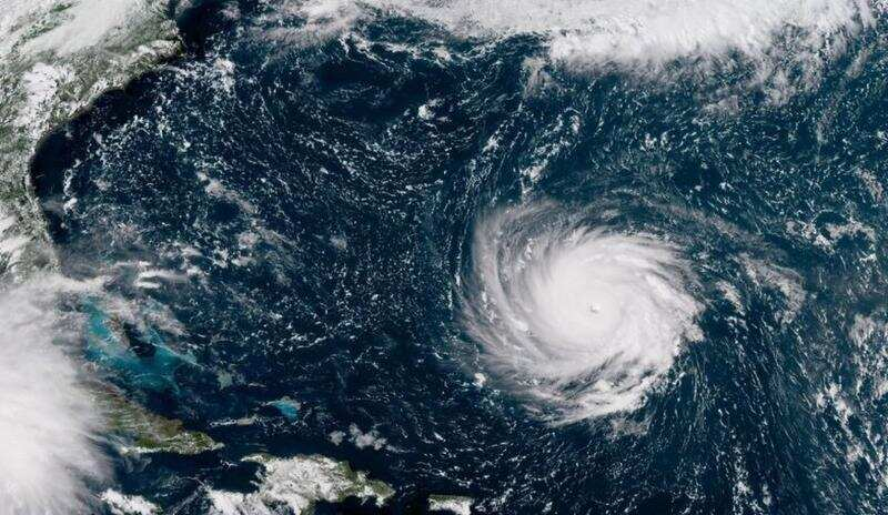


After developing off the coast of West Africa in late September, Hurricane Lorenzo took 11 days to reach the west coast of Ireland and the UK. In addition to record-breaking heavy rainfall, Lorenzo wrought major damage on the British Isles and other places lying along its path, like the Azores. Hurricane Lorenzo is the strongest recorded storm to have made it so far east in the northern Atlantic Ocean.
Kai Melamed-Turkish, a Master’s student in the Department of Atmospheric and Oceanic Sciences at McGill, explained that there are two main criteria for hurricanes to develop.
“One of the major factors that you need for a hurricane to form are warm sea surface temperatures […] of about 27 degrees Celsius,” Melamed-Turkish said in an interview with The McGill Tribune. “You also need relatively weak winds in the upper part of the atmosphere. You don’t want the winds to be too strong, or to be changing direction too much.”
In the case of Hurricane Lorenzo, the warm sea surface at its tropical development location provided it with ample energy for surface water evaporation. Once a hurricane has formed, it can only last if high sea surface temperatures and the jet stream, a concentration of relatively strong high-altitude winds in the atmosphere, carry it through its course.
“Normally in the Atlantic, we would have a pattern that tends to direct storms further west and at more southerly latitudes until they reach about the Caribbean or North America, and then they would start to make a turn towards the North,” Melamed-Turkish said. “But in the case of Lorenzo, that wasn’t quite the pattern. The wind pattern in the upper atmosphere allowed Lorenzo to make the turn towards the North and further east.”
Melamed-Turkish added that throughout Lorenzo’s northbound path, the sea surface temperatures remained above normal, which allowed the hurricane to build up energy and maintain its strength at latitudes further north than usual.
As the ocean surface in the Northern Hemisphere reached its warmest month in 140 years this past August, more extreme weather events are likely. Kevin Bloxam, a PhD candidate in the Department of Atmospheric and Oceanic Sciences, advised against directly attributing the longevity of Hurricane Lorenzo to climate change, however, drawing an analogy of steroid doping in baseball games.
“It’s hard to actually separate which [home run] was hit because of the [player’s] natural ability from which one was caused by the amplification [of drug use],” Bloxam said.
While scientists cannot say for sure what is to blame for a single extreme weather event such as Hurricane Lorenzo, climate change will certainly increase the frequency of such events. As a recent study in Nature found, higher temperatures in the Arctic can cause variations in the jet stream in certain parts of the world. This weakening of the jet stream produces meteorological extremities such as unusual intrusions of cold air from the Arctic into the middle latitudes, as well as prolonged heat waves and dry conditions.
With both rising sea levels and increasingly frequent extreme weather events, Melamed-Turkish expressed concern for populations along coasts.
“With a rise in sea level, it makes it easier for these storms to bring water from the ocean into major coastal cities,” Melamed-Turkish said.
Meanwhile, Bloxam urges both adaptation and mitigation in protecting coastal cities.
“We have to collectively reduce our carbon emissions and also protect the people who are most vulnerable to climate change at this moment,” Bloxam said.